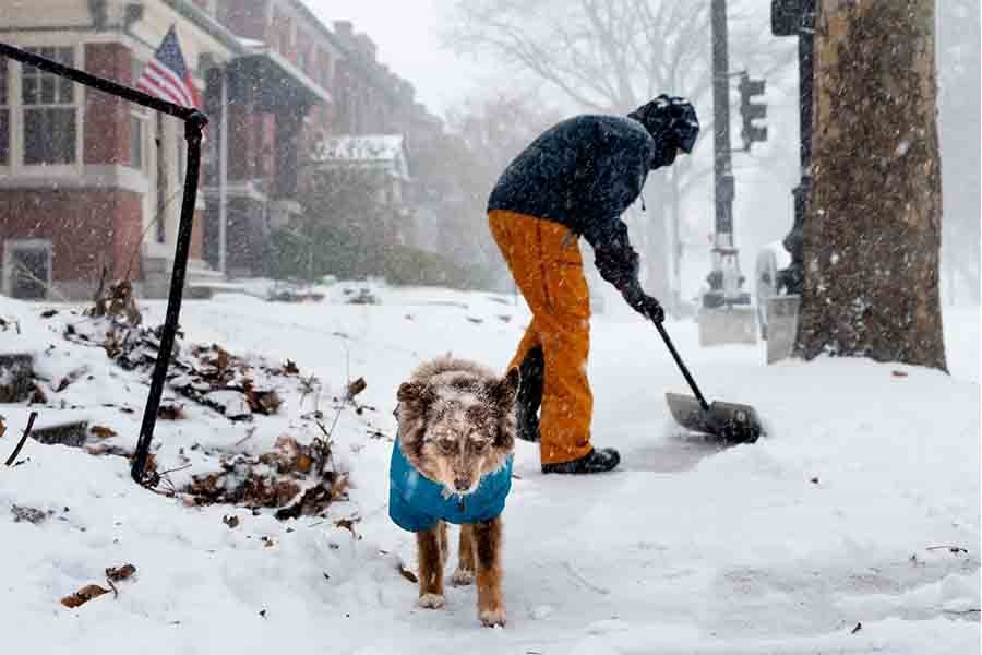
- Winter Storm Blair delivers heavy snow and ice from the Ohio Valley to the Mid-Atlantic.
- Kansas City records its heaviest snowstorm in 30 years, with 11 inches of snow.
- Nearly 250,000 households are without power in multiple states, with restoration efforts underway.
- Major travel disruptions include flight cancellations and dangerous road conditions.
- Residents are urged to stay informed, limit travel, and prepare for extended outages.
Winter Storm Blair is wreaking havoc across the Midwest, Ohio Valley, and Mid-Atlantic regions, with heavy snowfall, ice storms, and subfreezing temperatures. The severe weather has caused major disruptions to travel, widespread power outages, and hazardous conditions for millions of people.
The National Weather Service issued winter storm warnings covering areas from the mid-Mississippi and Ohio Valleys to the Mid-Atlantic, including major cities like Baltimore, Washington, D.C., Cincinnati, Indianapolis, Louisville, and Pittsburgh. Authorities have advised residents to stay indoors and avoid unnecessary travel as the storm progresses.
Midwest Records Historic Snowfall
The Midwest bore the initial impact of Winter Storm Blair over the weekend, with Kansas City receiving an astonishing 11 inches of snow on Sunday. This marked the city’s heaviest snowfall in over three decades, since February 1993. The sudden accumulation brought life to a standstill as roads became hazardous, and travel was severely disrupted.
Meanwhile, Topeka, Kansas, experienced a two-day snowfall totaling 14.1 inches, ranking as the fourth-largest in the city’s recorded history. Some areas in northeast Kansas faced even more extreme conditions, with snow accumulations reaching up to 18 inches. As a result, travel in these regions became nearly impossible, leaving residents stranded and reliant on emergency services.
Travel Chaos Across Multiple States
Heavy snow and ice caused significant disruptions to air and road travel. Over 50% of flights at Washington, D.C.’s Reagan National Airport were canceled due to snow-covered runways and low visibility. Baltimore-Washington International Airport and Dulles International Airport also experienced delays and cancellations.
Road conditions have deteriorated significantly, with authorities in affected areas urging people to avoid non-essential travel. Snow-packed and icy roads have led to accidents, making travel increasingly dangerous for those attempting to navigate the storm’s impact.
Several states have reported road closures due to hazardous conditions. Even primary roads have become treacherous, particularly in regions with continuous snowfall, leaving many stranded and delaying essential services.
Power Outages Leave Thousands in the Dark
Nearly 250,000 households and businesses are without electricity as the storm disrupts power lines across several states, including Kentucky, Indiana, West Virginia, Illinois, and Missouri. Utility companies have dispatched crews to restore power, but ongoing snow and ice accumulation are slowing their efforts. Residents are being urged to prepare for prolonged outages, with some areas likely to remain without power for several days.
Mid-Atlantic Hit Hard by Heavy Snow
The Mid-Atlantic has seen widespread snowfall and ice accumulation, with areas like Washington, D.C., and Baltimore reporting 5 to 6 inches of snow early Monday. Snowfall has reduced visibility to less than half a mile in some areas. Sleet began to mix with snow in parts of Washington, D.C., by 7 a.m. EST. At Ronald Reagan Washington National Airport, the official snow total was 4.7 inches as of Monday morning.
Philadelphia and Pittsburgh are also experiencing significant snowfall, with travel disruptions expected throughout the day. In Charleston, West Virginia, freezing rain and snow have created treacherous conditions, prompting authorities to issue emergency weather alerts.
Safety Recommendations for Residents
Authorities have stressed the importance of safety during this severe weather event. Here are key recommendations for residents in affected areas:
- Stay Indoors: Limit outdoor activities to emergencies. If you must travel, use extreme caution and equip your vehicle with emergency supplies.
- Prepare for Power Outages: Keep flashlights, batteries, and blankets on hand. Charge all mobile devices and consider using backup power sources if available.
- Stay Warm: Ensure adequate heating and wear layers of warm clothing. Check on vulnerable individuals, including the elderly, to ensure their safety.
- Monitor Updates: Follow local news and weather channels for real-time updates on storm conditions and advisories.
Storm’s Ongoing Impact
The storm is expected to continue its eastward progression through Monday night. Snow and ice are likely to taper off from west to east, but residual effects will persist. As a result, slippery roads and leftover snow could still cause travel disruptions Tuesday morning in areas like Cincinnati, Philadelphia, and Pittsburgh.
Meanwhile, cleanup efforts have already begun in parts of the Midwest, where the storm has started to weaken. However, restoring normalcy will take time. In particular, regions like Kansas City and Topeka, which experienced historic snowfall, will require extended recovery.
While the storm moves eastward, authorities are closely monitoring conditions. Power outages remain a concern, with many residents still without electricity in several states. Crews are working tirelessly to restore power, but challenges such as downed trees and hazardous conditions will prolong efforts.
In conclusion, Winter Storm Blair has caused widespread disruption across multiple regions, from the Midwest to the Mid-Atlantic. Its impact on travel, power infrastructure, and daily life has been significant. Residents are urged to remain cautious, stay informed, and take all necessary precautions until the storm passes and conditions improve.


